
In a conversation late last year (at the TAPR DCC) I was asked what is the actual level of APRS activity in Ireland. Thinking about the answer for a while, I realised that I really didn’t know, and that got me wondering how to go about visualising it.
I quickly came across Leaflet.heat, a Leaflet plugin plugin for generating heatmaps, so I bodged together some python to grab packets of moving stations from the APRS-IS backbone and put them into a format Leaflet.heat can read. After gathering about 6000 data points, here is what it looks like:
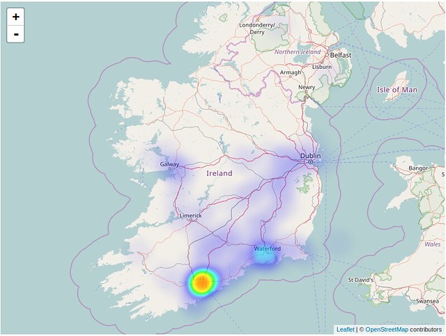
So, there you go, it is fairly conclusive that Cork city has the most ‘on-air’ APRS activity. This is followed by Waterford area, Galway area and then the main motorways.